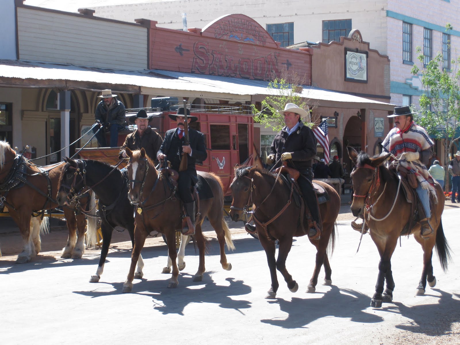
Arrived north of Tucson Thursday afternoon. We stayed at Catalina State Park (bottom picture) located at the base of the Catalina Mountains. Nice park with the mountains visible from all angles. We visited Mel, Kathy and Delores for the three days we were around. We had high winds on Friday, rain on Saturday (with snow, YES, snow) in the higher elevation where we were. We went to the Oracle Inn for dinner Saturday night and there was 5 to 6 inches of white stuff on cars sitting in the parking lot. All around on the ground and trees was a white, cold covering of snow. Luckily it didn't stick on the roads and we were not stranded. Sunday morning we took a jaunt south of Tucson to Bisbee and Tombstone. Bisbee is an old mining town with an operating copper mine (second from bottom picture on the right) still in existence today. It is built in a canyon and all the residents seem to live on a hill. Everyone has heard of Tombstone, home of the gunfight at the OK Corral. They have people and actors in period clothing all over the town. (Top center, left center picture). The boardwalks and old western buildings do much to convey the message one has 'stepped back in time'. There is an authentic Butterfield stage coach (top left picture) pulled by mules doing tours of the city. We splurged and took the stagecoach on a short ride through the streets of Tombstone. We stopped by 'Boothill' (top right picture) on our way out of town. There we viewed some old graves from Tombstone's historical past. Clantons, McClaurys, "China" Mary and other noted people. Well worth the visit, but back to Tucson.
Wednesday, April 13, 2011
Wednesday, April 6, 2011
Leaving Yuma
Chores are done, errands have been completed, laundry all dry and put away. Guess that means it is time to leave Yuma. Made one last trip to Los Algodones and said our goodbyes to Mexico. We will head to Tucson Thursday morning, hopefully before the windstorm that's supposed to be headed this direction. The lot is all secured and anything not nailed down is put away. Adios little car. Adios cactus, agave, plants and palm trees. Adios Yuma crunch and warm bright sunshine. Adios to all our Yuma family and friends. Catch you on the road!!
Sunday, March 20, 2011
Spring has Sprung
Friday, November 12, 2010
Out of Texas
We finally fueled up and headed out of Texas. Anthony is the last city, or town, in Texas you pass through before crossing into New Mexico. We did actually cross into NM. Honest, we really did. See the sign?? It says welcome. This is where we actually crossed the Rio Grande, not much of river anymore, as it flows south from the mountains around Albuquerque. If we were to jump on I-25 headed north, we could follow it further. Alas, we parted ways in Las Cruces and continued West. New Mexico roads aren't a whole lot different from Texas, (or any where else actually) and we didn't travel a whole lot through New Mexico. Our ultimate destination was Arizona. The sign entering there also says welcome. (People are so friendly here, but that's another story, another time)!? The sun was setting again, so we decided to make an additional stop for the night in Eloy, AZ. This was outside of Casa Grande. We could have continued on, but didn't feel we had to fight the sun in our eyes and arrive Yuma in the dark and try to get setup. We opted for an early night and joined the party at the RV park in Eloy for cake and ice cream. (Halloween and a birthday to boot). A little walk with the doggies and we were all ready to turn in early. Yuma was looming on the horizon. Not long now!!
The Rio Grande and El Paso
El Paso city, on the Rio Grande. (You can almost hear the words to the old song here, huh)? There is almost 600 miles from San Antonio to El Paso. (548 according to the Texas map we picked up along the way). We are not in a real big hurry, so we stopped along the way and spent the night in an RV park outside of Balmorhea. Stopping before dark allowed us to grab a sunset picture and then a sunrise shot also. (Can you guess which is which)? I have hint for you. The one with the power pole is the sunrise. Unfortunately we couldn't move far enough right or left to get it out of view, so think of it as a marker. We headed out shortly after sunrise. The dogs had their breakfast and we had coffee. We couldn't get over the speed limit in Texas. 80 mph for cars and 65 mph for trucks and night time. We continued westward, along the Quitman Mountains. Do you see the Rio Grande?? We couldn't either. We needed to get closer to El Paso. There we got our 1st view of the Rio Grande. The center of the river is the boundry between the U.S. and Mexico. The mountains off in the distance are in Mexico. El Paso is a large industrial city, sprawled out through the valley, bordering the town of Juarez, Mexico. The Rio Grande is all that separates these two cities. Lots and lots of people live here. Lots and lots of traffic through the city. I would like to say it is the largest city on the border with Mexico, but our friend Linda was corrected when she posted this fact. Thus, I will refrain and we will move on.
Leaving San Antonio
Roads leave San Antonio every which way. West is our direction, so West we head. I-10 is a long and winding road. Not a whole lot of traffic once you get away from San Antonio. This was a relief as we motored on down the road. The Interstate road system commissioned by the Eisenhower admimistration in the late 50's and early 60's criss-crosses the U.S. in every direction. The road we travel follows through canyons cut from the rock, still baring the scars of the drill. It becomes quite long and even the puppies couldn't resist a nap.
Friday, October 29, 2010
SAN ANTONIO STROLL
Remember the Alamo, but take a San Antonio Stroll. We did this in two parts. First the Alamo where Santa Ana, self-proclaimed Mexican leader, with more than 2000 soldiers laid seige to less than 200 Americans trying to protect a fort and a mission on the San Antonio River in 1836. One of the protectors of the fort was Davy Crockett, alas, all perished when Santa Ana stormed the fort. The Long Barrack and the mission (The Alamo) is all that remains today. The 175th Anniversary of the fall of the fort is in 2011. Part two is the stroll along the famous "Riverwalk" in San Antonio. You actually walk along a man-made canal, about four feet deep, carved to relieve flood waters at one time. Don't know how long it actually is, but we walked it all, first one side and then the other. We even had lunch at the Casa Rio, the first restaurant to offer outside seating along the river in 1946. (You can recognize it by the colorful umbrellas on each table). It was a beautiful day, reaching into the high 70's, but the walk along the river was shaded and cooler than up above on the street. Paco and Pepe enjoyed that stroll too. They didn't have to walk though, as we carried them for security reasons. Tired little puppies by time we were done. The dogs too!!
Subscribe to:
Posts (Atom)